Unlike the IPTC location fields, which provide incomplete and sometimes subjective information about a location, GPS data can provide an objectively precise position. The IPTC fields may only be able to say, for example, that you took a photo in the Tasmanian State Forest, Tasmania, Australia, but GPS data can pinpoint a location of 41° 13’ 58” S, +147° 59’ 12” E, which is a precise spot within the state forest.
Not only does GPS data enable more precision, it can stand the test of time. Place names change: countries rise and fall, people buy and sell property, earth is turned to street, and buildings are built and torn down. With map coordinates and a timestamp, you’ll never have to doubt where a photo was made. And the location tag, in conjunction with a timestamp and IPTC location names, can become an important record of the history of a place.
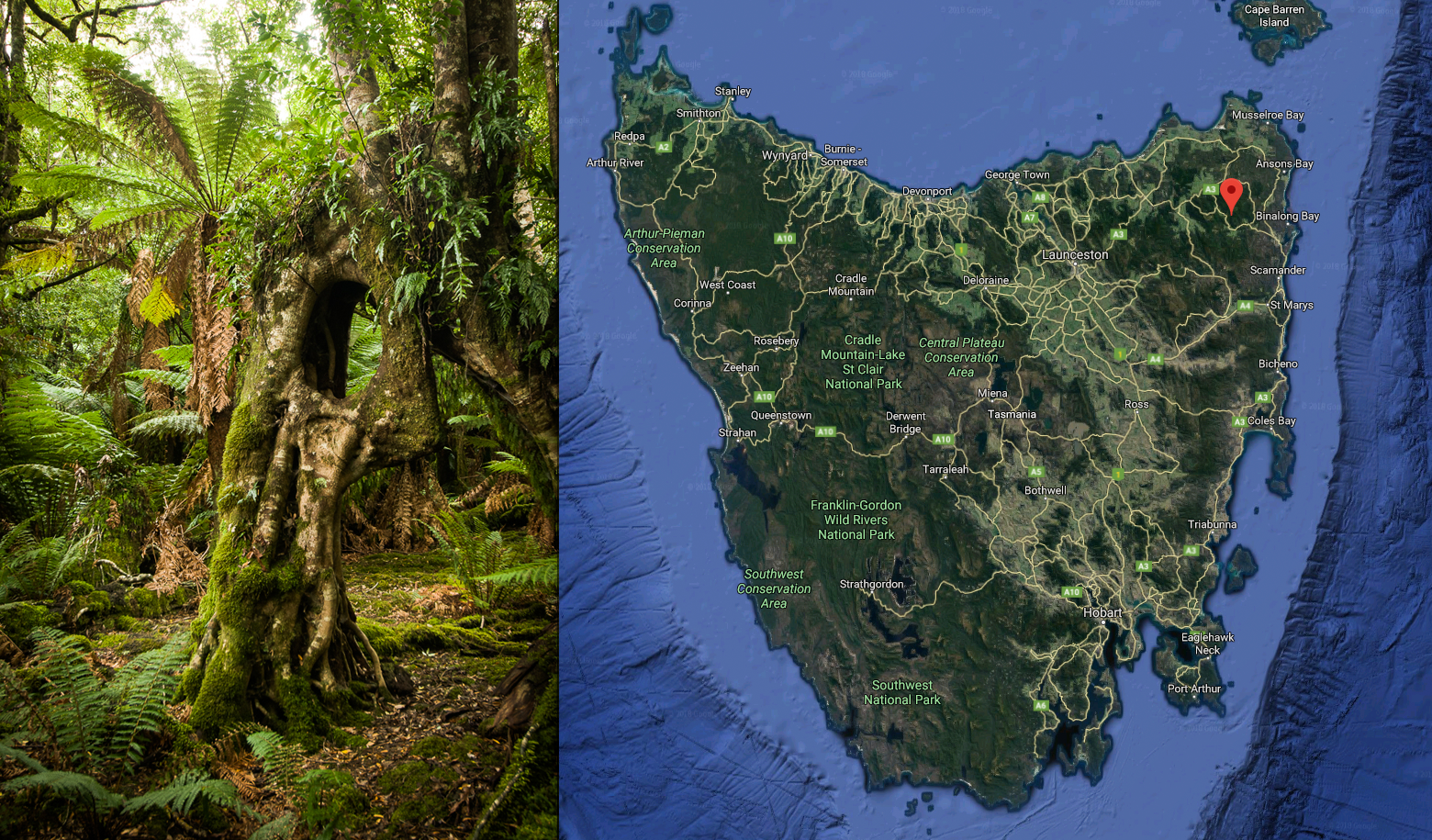
GPS can pinpoint an exact location in a place that is not well subdivided into small locations.
Promotes integration
GPS coordinates also allow for integration in ways that are not equally possible with the IPTC fields.
- GPS coordinates are not language-dependent. GPS coordinates can be accurately placed on a map.
- GPS data can be more effectively integrated with databases that provide information about the location.
- GPS tags can be used to generate IPTC place names automatically.
- GPS coordinates allow you to record more about the exact sublocation than the IPTC field does.
- GPS tags, along with a time stamp, can be used to automatically identify an event such as a football game or a disease outbreak.
About GPS Tags
GPS tags for photos can pinpoint latitude, longitude, altitude and a timestamp. GPS tags can also include information about the rate and direction of travel. GPS tags are supported by both the EXIF and IPTC standards, and we’ve come to expect that almost all smartphone photos will have a location tag.
GPS coordinates can be written in one of two common ways. Latitude and longitude can be noted in either degrees, minutes, and seconds, or degrees and decimals. These look similar, but they produce different results and should not be confused. The figure below shows both methods of notation. GPX and EXIF both use the minutes and seconds option.
Metadata embedded in the EXIF needs to be in GPS Exchange Format (GPX), an open standard XML schema for recording position and direction information. It includes latitude, longitude, altitude, timestamp, and a bunch of other stuff that’s relevant to a larger travel record (not the location of a particular photo).
Google Maps shows both the degrees and decimals and the degrees, minutes, and seconds method to describe a location.
Reverse geocoding
It’s now common for GPS tags to be used to add place names to IPTC metadata by looking up the GPS data in a map database. As with other place name workflow, it gets harder to apply the correct term as you get to lower nodes of the tags. Country is usually easy, as is state or province. But the city level may often be represented by several different options. For instance, my “city” is described in different databases as Kensington, Silver Spring, Montgomery County or Homewood. And the bottom node is even more tricky, as discussed earlier.
Most reverse geocoding does require some human-powered quality control for the bottom two layers. Some reverse geocoding apps will let you choose among different databases for geotagging. And others may allow you to add your own custom names for particular location regions.
Tracklogs
Smartphones and GPS devices can usually keep a tracklog which saves a set of waypoint coordinates along with a timestamp. This can be merged with an image’s timestamp to make the geotag at a later date. This is a good technique to use if your camera does not have onboard GPS capability. There are quite a few applications that can tag images from a tracklog. The figure below shows how a waypoint is saved in a tracklog.
Here is a waypoint from a tracklog. Note that the trackpoint time stamp is GMT, not the local time zone. Most geocoding applications will require you to manually adjust the timezone offset to match the setting you had on your camera.